
Guide · The globe & navigation
Guide · 02
The globe & navigation
How to move around the globe with a mouse, a touch screen or the keyboard, and how the map changes as you get closer.
Mouse and trackpad
| To | Do this |
|---|---|
| Pan (spin the globe) | Left-click and drag |
| Zoom | Scroll wheel, or right-click and drag up and down |
| Tilt and look around (3D) | Middle-click and drag, or hold Ctrl and left-drag |
| Open a card | Click a state, county, precinct, pin or district label |
| Preview | Hover over a shape to see its name and margin |
Touch
- Pan: drag with one finger.
- Zoom: pinch.
- Tilt or rotate: drag with two fingers.
- Open a card: tap. On a phone, cards open as a sheet from the bottom of the screen.
On a phone, the side rails become full-width sheets. Both start hidden and only one is open at a time.
Keyboard
| Key | What it does |
|---|---|
| [ | Hide or show the left rail (Data Layers, Scenes) |
| ] | Hide or show the right rail (Display) |
| Esc | Close the focused card, or else the newest unpinned card. Also closes the start screen. |
| ← → | On the party switch, move between Everyone, Republican and Democratic |
| Arrows on a rail edge | Resize the rail. Hold Shift to move four times faster. Home and End jump to the minimum and maximum width. Enter resets it. |
| Arrows on a card's grip | Move the card. Home puts it back. |
| Tab | Move through every button, chip and link. The focus ring shows where you are. |
You can also drag a rail's inner edge to resize it, from 260 to 560 pixels wide. Double-click the edge to reset it. Each hidden rail leaves a slim tab on the screen edge (‹ LAYERS [ and DISPLAY ] ›) that brings it back.
What shows at each altitude
The map changes as you zoom so it stays readable.
| Altitude | What you see |
|---|---|
| Above 3,400 km | States, coloured by the 2024 result. State borders are always on. |
| Below 3,400 km | Counties take over, and the precincts of the state under the camera start to load. |
| Below 2,800 km | Precincts replace counties wherever a state's precincts or a county edition are switched on. |
| Below 900 km | Vote centres appear. |
| Below 320 km | Precinct chair pins appear. |
| Below 150 km | Precinct outlines appear in the county editions. |
| Below 30 km | Precinct numbers appear. |
| Below 20 km | Colour fills thin out so you can see the streets underneath. |
3D street view
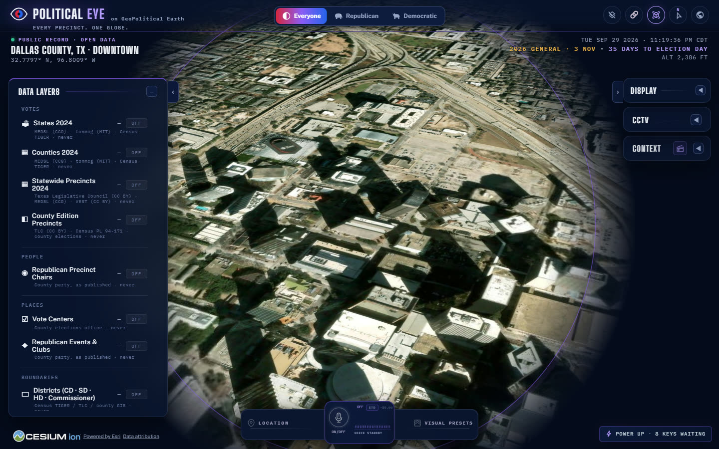
Keep zooming in and the globe becomes a city. Tilt with the middle mouse button (or Ctrl and drag, or two fingers) to look across the streets. The readout at the top right shows your altitude in feet, or in miles above 10,000 feet.
The Location button in the dock searches for a place and flies there.